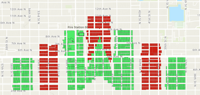
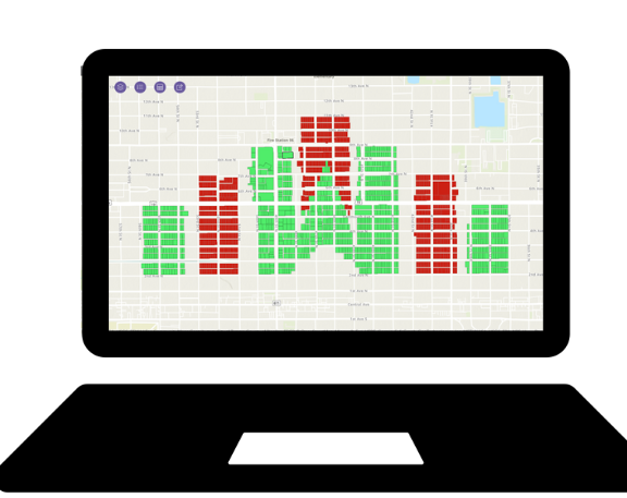
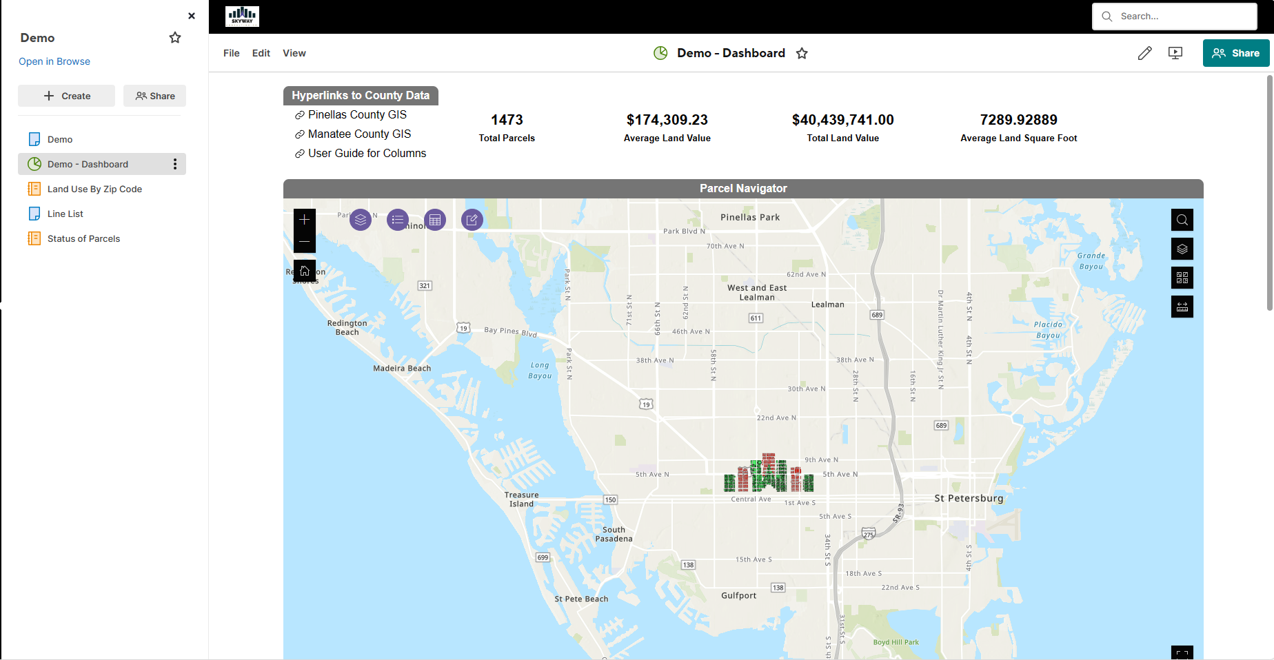
Integrating Smartsheet and GIS generates many possibilities, from leveraging the infinite data stores of county government to collecting GPS points from a fillable form.
Embedded Map
This seamless integration allows for real-time geographic data visualization and enhanced project management, providing a comprehensive view of your energy projects at a glance.
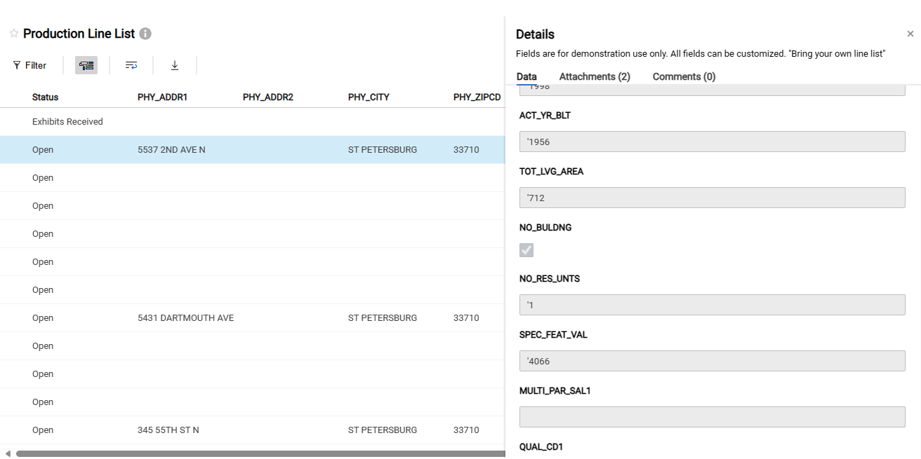
Shared Attributes
Our integration synchronizes Smartsheet's Dynamic View with GIS attribute tables, ensuring real-time sharing and updating of data, enabling streamlined management of project-specific attributes directly within Smartsheet
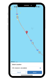
Mobile Data Collection
Our solution facilitates mobile data collection, integrating field-collected GIS data seamlessly into Smartsheet, enhancing real-time project tracking and decision-making on-the-go
Collaborative Feedback
Fosters collaborative feedback, allowing team members to contribute and update GIS data within Smartsheet, ensuring dynamic, team-driven project insights and enhancements.
Real Time Updates
We are delivering real-time updates, ensuring immediate reflection of changes in GIS data within Smartsheet, enabling up-to-the-minute project tracking and decision-making.
Single Source of Truth
Createing a single source of truth by consolidating GIS and Smartsheet data, ensuring consistent, accurate information accessible to all team members for informed decision-making.
How to Add A Map to Smartsheet
Embedding a map in Smartsheet is only a part of the equation. Read this article to better understand how to add GIS to your workflows.
Explore the range of use cases for the Smartsheet and GIS integration.
- Infrastructure Management: Tracks and manages utility assets like pipelines and electric grids, using GIS for spatial data and Smartsheet for operational details.
- Outage Response: Coordinates rapid response to outages with GIS mapping outages and Smartsheet managing response teams and resources.
- Regulatory Compliance: Ensures adherence to regulations with GIS providing geographical compliance data and Smartsheet tracking regulatory tasks and deadlines.
- Site Planning and Analysis: Utilizes GIS for analyzing potential construction sites and environmental impacts, with Smartsheet managing project approvals and documentation.
- Resource and Supply Chain Management: Manages logistics and resources, with GIS tracking material locations and Smartsheet handling scheduling and procurement.
- Safety and Risk Management: Identifies potential safety hazards using GIS, while Smartsheet tracks safety protocols and incident reports.
- Renewable Energy Siting: Analyzes locations for renewable energy projects using GIS, and manages project development stages in Smartsheet.
- Environmental Impact Assessments: GIS provides data on environmental impacts, and Smartsheet is used for managing the assessment process and stakeholder engagement.
- Asset Lifecycle Management: Manages the lifecycle of energy assets, from installation to maintenance, using GIS for location tracking and Smartsheet for operational management.
- Urban Planning and Development: GIS is used for spatial planning and analysis, while Smartsheet manages project timelines and community engagement.
- Emergency Management and Response: Coordinates emergency responses using GIS for real-time situational awareness and Smartsheet for resource allocation and task tracking.
- Public Works and Infrastructure Projects: Manages public infrastructure projects, with GIS providing geographical data and Smartsheet handling project management and stakeholder communication.
How to Get It
Third-party applications and services are subject to any end user license agreements that accompany them. Contact us to learn more about using Smartsheet and GIS integration products. After a successful deployment you will take ownership of the solution, or we can manage it for you.